
This is the second of my Archaeological walks this week. Like the first, this one is based on a walk along the ancient path the Ridgeway, reputedly England’s oldest road. This walk is fairly easy with very little climbing and is over a well made path making this an ideal walk to have with the children or grandchildren.
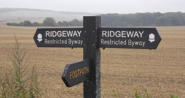
The walk starts and finishes at the National Trust car park for Uffington Castle/Whitehorse Hill (SU 29301 86576). From the car path follow the road up onto the Ridgeway. Turn right and following the path to the Neolithic Long Barrow Wayland’s Smithy. Retrace your steps along the Ridgeway until you reach the Iron Age Hill Fort of Uffington Castle. Take time to thoroughly explore this area making sure you get to see the White Horse carved into the chalk bedrock.
From Uffington Castle you can either return directly to the car park or to extend the walk continue east along the Ridgeway to the now almost non-existent site of Rams Fort. Several excavations have relieved it may have started life as a Neolithic Causewayed enclosure before being fortified during the Bronze and early Iron Age. It may have predated Uffington Castle.

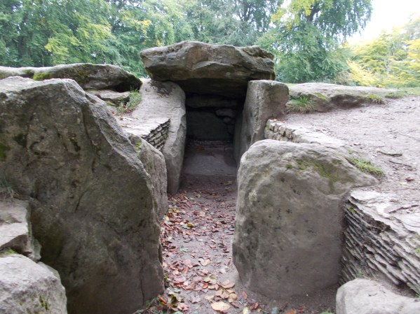
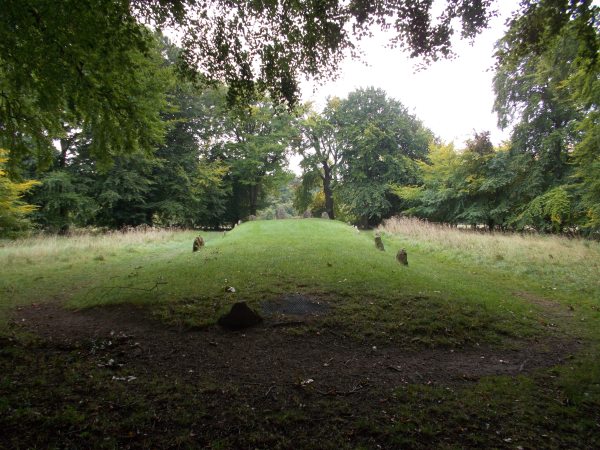
Wayland’s Smithy is a Neolithic Long Barrow and chamber tomb. Built in two phases, the first, a timber chambered oval barrow built around 3590 – 3550 BCE. Later covered by a stone chambered long barrow around 3460 – 3400 BCE.

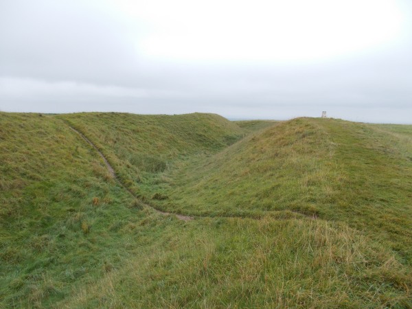
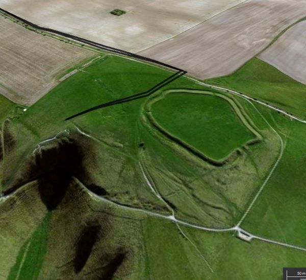
Uffington Castle, an early Iron Age (with underlying Bronze Age) univallate hill fort. It consists of a large enclosure measuring 220 metres by 160 metres and is surrounded by two earthen ramparts and a single ditch. The entrance to the hillfort is at the western end. Excavations shows evidence of structures within the enclosure relating to the hillforts occupation. Pottery and coins have also been found in burial chambers near by. The fort was probably built in the 7th or 8th century BCE and remained occupied throughout the Iron Age.


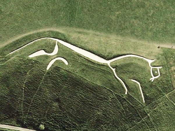
The Uffington White Horse is a stylised prehistoric hill figure 110m long formed from deep trenches filled with crushed chalk. The date of the white horse was assumed to be late Bronze Age or Iron Age based on the Celtic style artwork. However, scientific dating by the Oxford Archaeological Unit puts the date sometime between 1380 and 550 BCE making it late Bronze/early Iron Age.

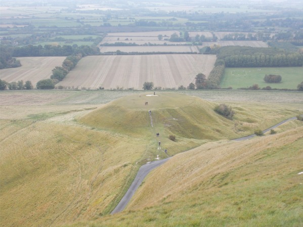
Dragon Hill is a natural chalk hill with an artificial flat-top situated immediately below the prehistoric white horse. Legend claims that on its summit St George Slew the Dragon and that its blood was spilt on a batch of chalk where no grass will now grow. It is more likely to be a Bronze/Iron Age ritual site related to the associated White Horse
This was another short but educational walk covering 3000 years of our history from the Neolithic to the Iron Age. It is a great one for the kids as there is plenty of room to play and enjoy themselves in the hillfort and adjacent to the car park. To top it all, White Horse Hill is also the highest point in Oxfordshire (so that’s another tick in the box).

Very interesting. But needs proof-reading ! Thanks.
LikeLike
Hi Charles – Thanks for the comment, you are right I did find one spelling mistake.
LikeLike