
Map Reading & Navigation – Training Resources
I could write an entire book on how to read a map and use a compass. I could use the best pictures with clear and concise explanations on how to navigate. But at the end of the day there is nothing better than real hands on training.
Now there are two different ways to learn. The first is by, what I call, osmosis, and the second is to attend a recognised course.
The osmosis method is the way that I learnt initially. It is done by watching others navigate, asking questions and copying. You absorb information and the continual use develops a skill base. The down side to this method is that it is best started when you are 5 or 6 years old and can take many years. This is how I learnt from my father and his colleagues.
The easier way, and the way that most people tend to use is by attending a recognised course. When I was a kid, you either learnt by joining the Scouts or Duke of Edinburgh’s Scheme. These days it is slightly easier, in that a search of Google (other search engines are available) will bring up a host of courses, all over the country, designed for all levels of ability.
![]()
A good place to start is the National Navigation Award Scheme website nnas.org.uk . The National Navigation Award Scheme (NNAS) was launched in 1994 at the Royal Institute of Navigation in London, and since then over 50,000 people of all ages have gained awards.
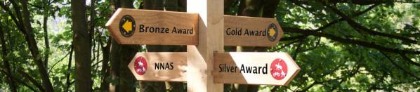
This is a great resource as it explains their Award progression, where the various courses are, and who teaches these courses. You can select by region or country, so you can customise their search to suit your requirements.
![]()
Another way is to go to a training school based on ‘word of mouth’. One of these has been used by numerous friends of mine and that is the Ultimate Navigation School ultimatenavigationschool.co.uk . They run Foundation, Intermediate and Advanced courses, courses dealing with GPS and Night Navigation. They also have specialist courses for MRT, Police, Fire & Rescue, Special Forces etc.
The Ultimate Navigation School was founded to provide the highest level of Navigation training in a clear, easy to understand, friendly way. When people enjoy learning they retain more and reach a higher level of ability. All their Net Profits goes to Charities who repair and maintain the Outdoors
I must make it clear that I have not used this company and there are other very good companies available.
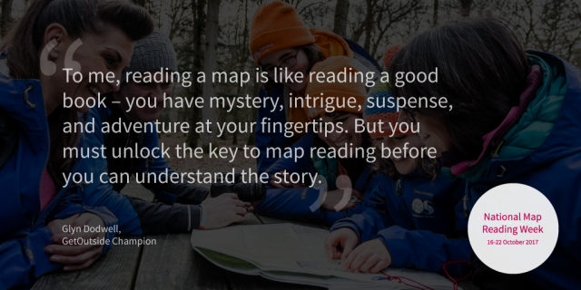
So there you have it. I have given you the basics and some idea of how to progress. It is now up to you to take this as far as you want. If you choose to go all of the way, you are opening up a world of adventure and exploration. I will leave you with my thoughts, taken from the National Map Reading Week 2017.
In Map Reading & Navigation – Part 10, I will cover any questions that you have for me. So if there is something that you want to know please leave feedback.
Page 8 —


Pingback: Map Reading & Navigation – Part 8 – Hill-Walking For The Over 60's
Thank you for the clear guidance, I just need to get out and practice!
With the OS App is it possible to download routes onto a GPS? I have the e trex 10 that I was hoping to use.
Many thanks, Pete
LikeLiked by 1 person
I am glad that you have found the series of blogs useful. the OS Map App can export a GPX file which can then be used in rTrex 10.
Regards Glyn
LikeLike