
![]() This is a 39 miles trail linking Liphook with Chichester Harbour. First conceived in the 1980’s by a group of Liphook Ramblers who devised a route from their hometown to Chichester Cathedral. The trail now follows rights of way from Liphook, on the Hampshire/West Sussex border, to East Head at the entrance to Chichester Harbour through the heart of the South Downs National Park.
This is a 39 miles trail linking Liphook with Chichester Harbour. First conceived in the 1980’s by a group of Liphook Ramblers who devised a route from their hometown to Chichester Cathedral. The trail now follows rights of way from Liphook, on the Hampshire/West Sussex border, to East Head at the entrance to Chichester Harbour through the heart of the South Downs National Park.
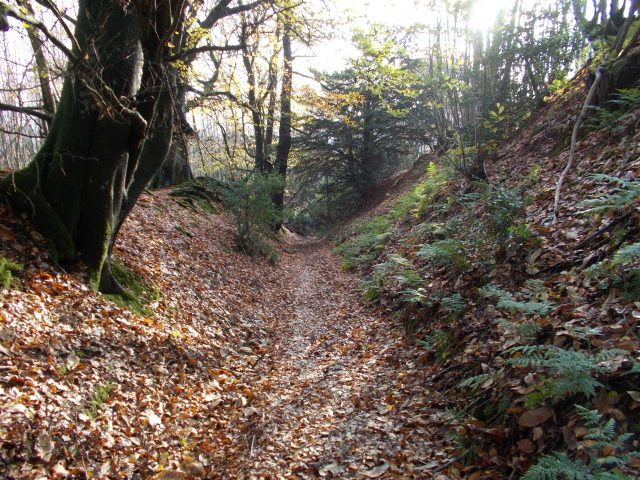
Being aligned north south, it crosses all the main geologies of West Sussex from the greensand ridges, through Wealden river valleys and heathlands, to the high chalk Downs and the coastal plain. In so doing it offers a great variety of scenery, flora and fauna.
The trail has be divided into 4 convenient stages covering the 39 miles and 2000 feet of ascent. Each stage is possible with the use of public transport if required.
Stage 1 – Liphook to Midhurst
Start: Liphook Railway Station SU 84164 30900
Finish: Midhurst Bus Station SU 88691 21821
Distance: 12.7 miles
Ascent: 1385 feet
Duration: 4h 45m

Transport: Train to Liphook, #92 Bus Midhurst to Petersfield Railway Station, Train home

Stage 2 – Midhurst to Singleton
Start: Midhurst Bus Station SU 88691 21821
Finish: Singleton SU 87687 13169
Distance: 8.5 miles
Ascent: 1097 ft
Duration: 3h 02m

Transport: Drive to Midhurst, #60 Bus Singleton to Midhurst, Drive Home


Stage 3 – Singleton to Chichester
Start: Singleton SU 87687 13169
Finish: Chichester Bus Station SU 85996 04330
Distance: 10.58 miles
Ascent: 564 feet
Duration: 2h 50m

Transport: Train to Chichester, #60 Bus to Singleton, Train home


Stage 4 – Chichester to East Head, West Wittering
Start: Chichester Bus Station SU 85996 04330
Finish: East Head, West Wittering SZ 76562 98430
Distance: 11.85 miles
Ascent: 103 feet
Duration: 3h 30m

Transport: Drive to West Wittering, #52/53 Bus West Wittering to Chichester Bus Station, Drive Home


Overall Statistics
Total distance walked to complete the trail – 43.63 miles
Total time taken to complete the trail – 14h 07m
Total elevation gain to complete the trail – 3149 feet

Caution
This route is poorly waymarked, so please make sure you have a map with you as there are some very confusing sections.
Ordnance Survey Maps Required
OL33 Haslemere & Petersfield
OL8 Chichester, South Harting & Selsey


Lovely photos Glyn, always love autumn mists and colours. Hope your calf heals soon xx
LikeLike